Problem
How can health infrastructure be mapped spatially to support accessibility planning and public transparency?
Statewide GIS mapping of hospitals and clinics on Bhuvan for public infrastructure visibility and planning.
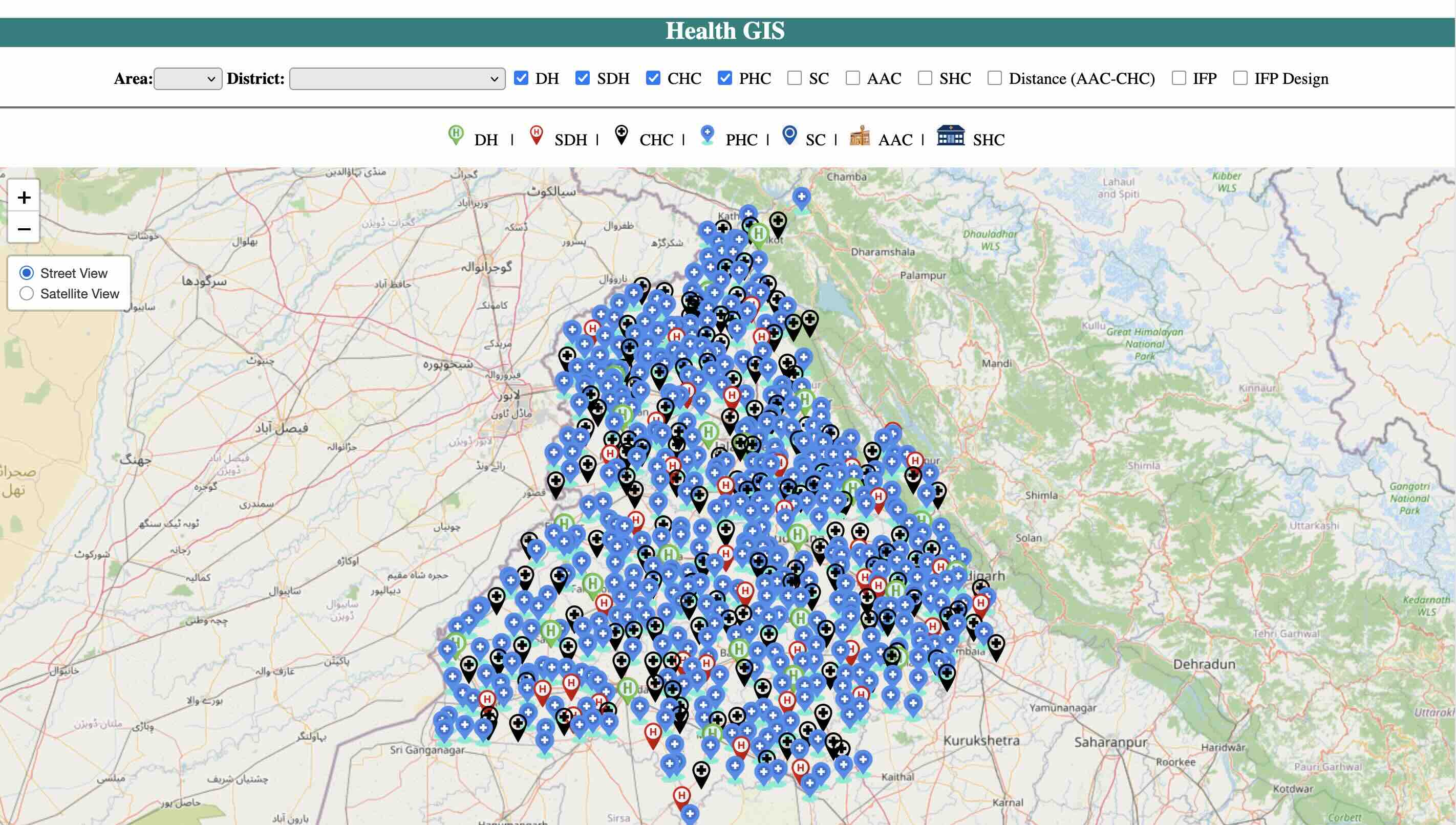
How can health infrastructure be mapped spatially to support accessibility planning and public transparency?
As nodal officer, led GIS mapping collaboration with Punjab Remote Sensing Centre and migrated spatial and non-spatial health data to Bhuvan.
Aligned government spending, schemes, and outcomes with SDG targets through an annual Output-Outcome Monitoring Framework released with the state budget.
Read case study
Expanded SDG budget alignment coverage from 29% (2021-22) to 91% (2024-25) through a transparent departmental budgeting report.
Read case study
Built a rigorous district-level SDG index to rank performance, foster healthy competition, and guide evidence-based prioritisation.
Read case studyAvailable for SDG systems, health informatics, dashboards, PMU support, and governance reviews.
Start a conversation